** Click on the pictures for enlargement **
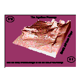
The Agulhas Passage, situated on the southern margin of Africa, at the junction of the Atlantic and Indian Oceans, offers a unique opportunity for investigating the history of the South Atlantic Ocean on a small scale.
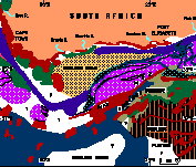
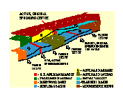
The framework
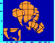
The pre-drift
The opening
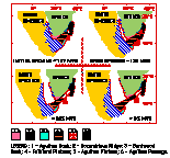
Changes in the rate of seafloor spreading, jumps in the ridge axis and associated volcanic and tectonic activity strongly modified basement morphology and influenced sedimentation.
The oceanic crust
The cross structure
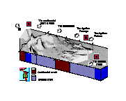
Also the morphology recalls the shapes of the understaying structures.
The morphology
The 3 D
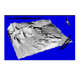
The 3 D/1
The marginal fracture ridge on the continental margin effectively damned the influx of terrigenous and shelf sediments into the passage, although structurally - controlled gullies in the upper slope allowed turbidites to flow down the slope and become ponded in the deepest parts of the passage. During the Pliocene, a large, tectonically-triggered slump formed at the northern end of the Passage.
The acoustic facies
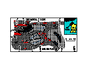
The thickness
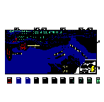
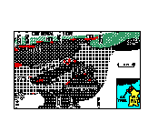
The sensible map reports the ship-tracks of eleven reflection seismic profiles.
They show (see content) the interpretation of the main characteristics of the examinated area, but only three (proff.1, 2 and 4) are sensibles and was presented in Rossi &Westall, 1994.
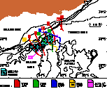
The ship-tracks

The framework
 The pre-drift | 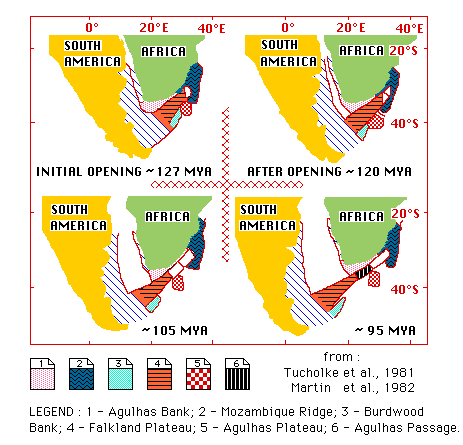 The opening |
|---|
 The oceanic crust |  The cross structure |
|---|
 The morphology | 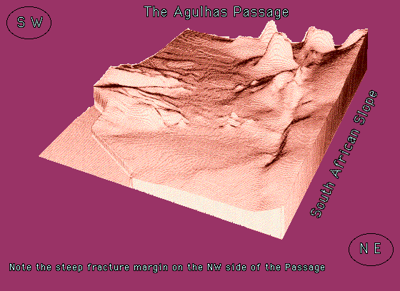 The 3 D |  The 3 D/1 |
|---|
 The acoustic facies |  The thickness |
|---|
The ship-tracks
Go home